Showing posts with label Mt Ashland. Show all posts

Tuesday, October 28, 2025

Thyme sweetened honey

I recently* ran across a somewhat breathy article on the hash tag SEVEN BEST STATES TO HIKE WITH GREMLINS AND MEN WITH BEARDS AND HATS or something.  I also saw a video from teh Hash Tag World's Greatest Ranking Person Or Thing, "Peak" Rankings. (TL;DR, they claim WA is less gooder than ID, which as a local to both states in various eras of life, I gotta say, sure, yeah, totally.  I mean Idaho is plumb full of zones like Hemispheres and The King and The Valley of The Cliffs and International and Schim's Meadow and Cowboy Mountain and Northback and Piss Pass and Bomber Cliffs and The Elk Chutes and Table and The Arm and the Microwave and and and and and.)  It got us thinking that we haven't rated the seven best states for skiing.  You're welcome.

1. Colorado.  Everybody knows it.  When it looks this good, you just can't help it:


Like all those WA Lotto Scratch ads, How Can You Not?


Really, CO has its share of true gems like Ski, Cooper, Ski, and Heartland, Woof Crick and the butterfly place.  There's a few little guys like Hesperus (if James Mercer can ever get it open) and Howelson Hill, which, history, adversity, all that, and Echo Mountain, that fit right in there with all the Midwesty joints everywhere.  There's enough not-Vail to fill a wheelbarrow twice and still have a few slices of Port Salut with lingonberry leftover.  Just don't tell me Breckenridge is the best cos everybody goes there or something.  I'd definitely rather ski Crescent Hill.  Which is in the Nebraska part of Iowa.

2. Denial.  I mean, let's be honest.  What's better than finishing a ski day, calling in sick for the next day, then going skiing again?  Nothing, that's what.  Well, actually, come to think of it, doing that when you are 11 and you're skipping school to avoid turning in a paper you were assigned a week prior before having nine days off for Spring Break that neither you nor your buddy Aram have started yet.


15 Mar 2020, yes.  THAT day.  Definitely in denial, definitely tryna mellow the state of anxiety, definitely at Bogus Basin, Boise NF, Boise County, ID.


3. Pain.  Pain kinda goes along with denial, if we're being honest.  I'm gonna keep goin even though it hurts.  It's gonna stop hurting any time, right?  I know it's arthritis and full thickness chondral loss, but if I just ignore it, it'll get better.  Do you have any Voltaren?  Skiing more will habituate the nerves to their current situation and they'll stop sending pain signals. I SAID DO YOU HAVE ANY VOLTAREN?!  I'll just adapt my technique a little.  Or my gear.  If I swap to a longer ski with a longer turn radius and then detune the life out of the edges with a bench grinder, then there won't be any radial torque on the joint.  That'll make it better, right?  Right?  WHAT DO YOU MEAN SAYING IT LOUDER DOESN'T MAKE ANY VOLTAREN APPEAR?!?!


YEAH BUT IS YOURS AUTOGRAPHED


4. Sobriety.  I'm not joking here, even though I almost always am.  Folks talk about startin in on the sowse at like 7.30 in the before noon, or that that liquid courage is the only thing that's gettin em down them thar black diamonds.  If you gotta plumb drunk yerself into doing something stupid, and think that skiing them thar black diamonds is stupid, come to think of it, maybe skiing isn't the best thing you could be doin with your time?  Just a thought.


Proud to say, just like meth, not even once.  Jägerbombs? What the actual f


5.  Solid.  This one's harder to clarify.  I mean, tube amps definitely sound better, but that one Boston song was pretty aight and I'm pretty sure everything that cat did was controlled down to the minute minutiae.  Then again, a nice warm tube amp, some juju I never understood, and a hollowbody, and everything ///bzzbzz THIS JUST IN /// TOM SHOLZ PLAYED A BUNCH OF TUBE AMPS NEVER MIND.  Wait, you were probly thinking states of matter cos snow is solid? BUT HOW DO THE CLOUDS EVEN GET HERE I ASK?!?!?  Never mind. Now I'm just confused.  As I was saying, snow is definitely best for skiing when it's in its solid state.  Water skiing? Heck no.  I'll take these midsize dirtrash scrapes on my arms from riding the mountain bike poorly over drowning in crappy shorts at the bottom of a dirty lake any day.

6. Delirium.  I mean, as long as it's metaphorical.  Delirious with wonder, or with amazement.  I imagine something like this:


Whatever floats yer boat, I guess.  Is this the thing what Lake Louise is talkin abote?


7.  Bliss.  Lest this sound like an ad for Tamarack, hear me out.  We lived in Ashland, lest you forget, and we learned from the best.  If you're blissed out on life, it doesn't matter if the world is crumbling around you or, like, Windsor is broken and there's wolverine-shaped demons in the trees.  Or if it hasn't snowed since October and it's January.  Or if it really is time to go to the ski swap and replace your '99 Piste Stinx with a real up-to-date ski, like the '01 Piste Stinx.  Or if, say, your Micro Grid Hoodie tee em smells like you haven't washed it since the Clinton administration.  I mean, tele till yer Melly is smelly, amirite?


8.  Norrbotten.  Shoot.  That's a county.  Never mind.  Still, it's home to one of the best names in skiing, Riksgränsen.  It's right on the border with Norway, such that you can physcially ski in both countries during one run.  Don't quote me on the political situation, but I'm pretty sure aside from The Swedes thinking The Norrmännen are hicks who only eat knock-off Icelandic food or something and The Norwegians calling The Svenskene Saab Driving Pickled Herring Bankers or whatever, you're good.  Oh, and the name?  If the various translation services available on a popular search engine currently in the late-middle stages of platform decay are to be believed, it means National Border.  And if you know anything bout me, you know I do love me some literal.


CO? More like CNO.  Norrbotten gots that good arctic sun and to us proud Americans, it's about as exotic as it gets.  You could tell me this was skiing in Tajikistan and I'd be like, okay, maybe it is.  But then I'd push up my glasses and be like, WELL ACTUALLY YOU SEE THAT U-SHAPED PASS IN THE DISTANCE JOKE'S ON YOU I KNOW ABISKO WHEN I SEE PICTURES OF IT.


Lest you doubt I could do it twice.  Never forget I am the best skier on the mountain.

-

Title from Steve Young's classic Seven Bridges Road, which you probly thought was written by The Angry Birbs or whoever just like everyone thinks Janis wrote Me and Bobby Flay.  And before you say it, yes, Steve Young is also that one quarterback who played for BYU.  I think he threw some NFL passes, too.  He's no Joe North Dakota, though, speaking of states that have skiing somewheres.

* Just now. On the internet.

And yes, I know it's Sunshine Village.  Don't at me.

bzzbzz///THIS JUST IN THE OWNER OF MOUNTAIN CAPITOL PARTNERS WHO ARE THE OWNERS OF HESPERUS IS ACTUALLY JAMES COLEMAN NOT JAMES MERCER THAT GUY'S IN THE SHINS SORRY FOR ANY CONFUSION THANKS


Now pretend he's in a football uniform.  I think it's the same guy.

Friday, December 22, 2023

Relatively easy

The hike out the King can take anywhere from 12 minutes to 2 hours, depending on your skill, familiarity, and fitness.  Mostly your familiarity, as you need to know where to just point it, where you can kick steps as fast as you're able until you almost puke knowing that the line you're sweating for is just past the top of a given pitch.  Skill helps, of course, cos those hard corners where you drop a shoulder and glide instead of skidding wide are much faster with the right amount of edge, and the speed'll let you carry up past ten or fifteen side steps other folks have taken, which saves your lungs for those three pitches on the actual peak where you need to kick hard to stay ahead of the Joeys from Bellevue in their bar-mode boots and this year's trendiest goggles.

I swear it's steeper than it looks. First Throne Gate, CM.


The first time I headed out, I think I was 7. All three of us tagged along with Pa, and I'm fairly certain I was the slowest.  My brothers would have been 10 and 12.  I obviously didn't know where I could pump a roller for an extra boost, or where I should double up to rest the legs for a half second of airtime.  The hike is all about conservation, whether it's momentum or lung power or quadriceps energy, and at 7 I knew about none of that. Somewhere in the middle of the second pitch on the shoulder of the King, we caught up to, or more likely were passed by, a couple around Pa's age. The wife, I'm pretty sure, had a Bota bag of apple juice.  I will never forget the taste.  I think about it, the Bota bag, the apple juice, the kindly lady I never saw again, every time I'm out South, or sidestepping out to Lower Mores here in the desert, or walking along one of the ridges at The Place That Shall Not Be Named, or skating back to the Lodge on the 20 Road after a quick Rabbit Ears lap at Mt A, when my throat burns cos I'm too stubborn lazy to carry water.

I don't remember which line we skied.  Knowing the sort of terrain Pa prefers, it was probly Southeast Right.  Wide open and steep, but manageable. Southeast facing, as you'd guess.  In my mid-to late-twenties, it was a ramp of much speed and few turns, but in the spring of 1989 it would have seemed endless.  I don't remember how many turns it took down to the exit, but it probly felt like a few hundred.  Those years in the late aughts tuning skis for Brad, I made a game of how few turns I could make from the top of the King to the bottom of the first pitch on either side.  My best was 4.

-

Yesterday, I woke up and realised I was 42 years old.  My birthday long past, but still, sometimes it sticks.  I know this is universal, whether you're 31 or 75 or 103, one day you're minding your own business, checking groceries, pumping gas, bumping chairs, riding bulls, sweeping dirt off your baseball pants from a successful steal of third in the deciding game of the CWS, playing a show in front of 3000, whatever, and the next day you're older, feeling broken, and praying to God the trade-off is one resulting in endless wisdom and old-guy strength.  Again, not unique amongst any peer group or novel in the scope of geographic time.  Just, well, hard to swallow sometimes.

This wasn't anywhere as steep in '008. Two Turn Eino? More like Two Hundred Forty-Two Turn Eino.


That day, the 4 turn day, was a Saturday.  It'd puked, then puked some more, and Patrol hadn't opened south all week, not even Friday.  (Stina always spat "Baugher's just waiting for Friday cos he hates locals!")  I knew it would open, and didn't have a shift in the shop, so I was planning to just head for the gate and wait until somebody dropped it and fight for whatever leftovers I could find.  Standing in line for 11, just before opening, the line stretching for two hundred people in front of me, I heard the Number Two Lifts Guy (no clue his name, this far on, but I'll call him Adam, cos why not) yell my name.  That year, '008, I was tuning most-time for Brad.  I'd got my pass through lifts thinking I'd need two jobs, so when I realised I couldn't swing both, I told Bob I'd help out when necessary and otherwise deal with fewer Greenbacks.  He didn't really need me much, and I usually skated by with the last of my tips.  That morning, though, they were short enough lifties that they actually needed me. 

Anyway, Adam wanders over and asks me if I can do lunches. Obviously, I can't say no, regardless, but I mumble something about getting one solitary South lap, and he says "Dude!  Of Course!  Gimme your time card and I'll punch you in. Come back and do lunches, go skiing some more, and clock out at 4."  Well, now.  To be honest, I don't even know if he ever clocked me in.  Or care.

That knowledge of the hike and traverse out south, it pays off sometimes.  There was a line at the False Summit, the second Throne Gate.  I kept booting until I was alone at the top of the Throne, only a short ski down the ridge to the A Basin saddle.  Everyone waiting in line for the lower gate had to traverse, duck the krummholz firs and pine and spruce at speed.  I just had to point it and hope the corners hadn't changed too much with all the snow. I had probly a 5, 6 minute head start on them, and I was faster than all of 'em, too.  I hit the bottom of the King knowing nobody could catch me, no matter how many were back there.  I had built another 4 or 5 minutes in by the top and could catch my breath, make my decisions, breathe some more, ignore the butterflies and the crowd at the top of 9, and be ready instead of jittery.  Brad and his now ex were second and third, surprisingly.  He rarely skied, but it was exactly the kinda day that he waited for.  High, thin, beautiful overcast, chilly enough to preserve the day-old snow, visibility clear and unlimited.  When he poked his head through the last whitebark, I looked quizzically, and asked "How'd you pull this off?" He just shrugged.  "How'd you?!" "I'm doing lunches, as you can see.  Hard at it." I saw the cloud of ants chasing them up the last pitch, waved, ignored his invitation to ski where he could see me, and dropped off to the northeast. Slid a directional turn on the ridge and dropped into the Hourglass, the easiest line off the top of the King.  Some lines just feel right, and I hadn't known it'd be that line until I rolled over and saw nothing but an open ramp.  Four turns at speed, whatever radius that is, down to DFF.

When I was shoveling the ramp at the top of Rex during one of the lunches, a pro patroller slid by and said "Nice turns. I know it was you."

You can't see the forest for the glaciers. Ingraham, Fryingpan, Emmons, Inter, Winthrop, Curtis, and Carbon, NE shoulder of Tahoma. There's more species of conifer in this pic than in all of SW Idaho. Name them all and you get 15 points.


The knees just don't work the way the should, and certainly not the way they did.  I remember one morning at the community college squatting outside Noël's old Acura 5-speed at 7 in the January morning, thinking my knees were done, and how unfair it was that I was only 18 and I was already being sold down the river by creaky joints.  I wasn't, though.  Through strength training, and, more importantly, telemarking 100 days a year and hiking 3000' vertical peaks all summer, the muscles and joints starting working together.  Once I got a bike and stopped with the horror of running, things really clicked and I had a stretch of 15 years with only one single second of true knee pain.  Just now, though, I settled weird in my seat to write these exact words and the lateral side of my right knee lit up with that same white flash.

-

Alta is known for traverses.  The High T is probly the best known, perhaps in the whole damn country.  I've never partaken, and to be honest I have no desire whatsoever.  I and Alta don't get along.  Taos, Bridger, Baker, and the like are known for bootpacks straight up to their respective ridgelines.  Mt A for complaining that the Bowl is closed while ignoring the technically-out-of-bounds south and west sides of the peak because the skate back on FR20 is there.  Not cos it's hard, because it just isn't.  Sun Valley for its glitz and septuagenarians ripping the groomers on the Warm Springs side at Mach Stupid.  Mad River Glen for its single chair, co-op structure, and for allegedly being hard AF.  Jay, for the waterslides.  You get it.

The Place That Shall Not Be Named, maybe none of those things.  They have those gilded bathrooms, the English wool carpet lining all of their countless lodges, the grooming, the 3000' vert of grooming.  Nobody talks about the short hikes to the actual reason to ski in Weber County, Utah, which is the same as anywhere else you can think of, even the Driftless.  Quiet, steep, not-always-safe turns in good, unsettled snow.  Not all of the lines are worth it.  Some, though, it's, well, shoot.  There are still some things I miss about Utah.  From the top of Strawberry, you boot up a little toward DeMoisy, then skate around the west side.  In many years, with some adventurous partners, you could drop Burch Creek all the way to town.  You ignore this, ignore the obvious lines back into Middle Bowl, skiers' left of DeMoisy proper, and keep skating and sidestepping and booting until you're on a ridge above a hidden bowl that empties down into the top of Porky.  You can't really see it from anywhere, and nobody will know you're there.  It's not the steepest spot on the hill, not exposed and terrifying like Mt Ogden, nor obvious like the north face of DeMoisy.  It's a ramp with probly 20 or 30 turns, and it's yours if you want it.

Some of the only truly good memories I have from that glitziest of hills are the handful of turns I made back there and the look some tourist lady gave me when I popped outa the limber pine onto the groomer at the top of Porky.  My moustache, drooping every day further below regs, caked in snow when it hadn't snowed in days.

It's right behind that rock, right there, and there's none of those pesky Joey traverse lines or strange skier people you don't know and yet somehow know you don't like.


The hard truths that take lifetimes to grasp don't first arrive as welcome rain drops on a light breeze after a three week drought, they hit like a 2 am tornado.  Just as convective storms are still hard for the atmospheric science hippies to pin down, these lessons, or insight, whatever you want to call 'em, do what they please, and you have to be paying attention at all times or it'll be years later and you'll sit up with a jolt because there was something to learn from that one moment, way back in 2012 or something, that you can't quite visualise.  Scientific understanding has taken millennia for this same reason, that most folks didn't know how to understand what just happened when all they could see is the black of the receding tornado and their belongings scattered hundreds of yards or even miles away.

-

By the time I hit the top of the King last winter, I was scraping rime off the gnarled 5-foot Pinus albicaulis to chew on for water and hoping the feeling in my chest would recede.  Four years of knee problems and anxiety and the fitness I spent all those years cobbling together is long gone, with the weight my far-northerly genes seem prone to add when I'm out of commission complicating things further, and that easy 15-minute hike took me probably 45, for most of which I was out of breath.

The view is the same, that slow spin to take it all in, one more time.  Maybe that was the last, I don't know.  Alterra hasn't made things better up there.  They can't significantly alter the landscape.  They are trying, though.  They are having success pushing out the locals, too, as they are in all of their gathered holdings, legacy and otherwise.  Heather Hansman and Hal Clifford have documented this part of our world better than I can.  Maybe it's obvious, maybe not, but when a large portion of a corporation is built on past legal misdoings--think Intrawest and the fraud they or at least stakeholders in the org committed--one has to wonder whether there's ever any goodwill at the heart of things.  One can't escape these things, only ignore them, and there's a line I can't cross.  It hurts.  It feels like I can never go home, and yes, maybe I should read that book.  I tried Look Homeward, Angel, but never finished it and I associated Wolfe with Kerouac too much and got bored.  I grew up at the exit of the valley, where the lahar fill spreads north and west and flattens the land.  We didn't leave to be gone, but to try to find greener pastures, and yes, the joke writes itself.  Enumclaw averages almost 60 inches of water a year, pretty much all of which falls as rain.  Ashland and Ogden get less than 20, and BoyCee many years never receives more than desert-level water.

From the top of the King, one can see peaks of all shapes, exotic terranes, volcanism old and young, forest, water, and even a little bit of desert.  The constant change and illusion of permanence.  The Emmons, that murderous and beautiful and terrifying glacier, is the biggest thing. It becomes the whole western sky if you don't look away.  It is magnetic, the largest area of any glacier in the lower 48.  If I could choose my death, which I don't want to do, part of me hopes it's underneath another lahar, down on the White some cool fall afternoon, oblivious and calm behind a giant redcedar trunk when the ground shakes and I have a few minutes to understand, to take it all in one last time.  As I said, I don't want to choose.  I hope I'm old and crazy, yelling at all the tourists downtown, some jerk of a business owner calling the cops on me again.

That run wasn't four turns, or even forty.  I was gripped, bordering on scared.  Such a strange feeling in a place I'd long felt at home and comfortable at speed.  I dropped into the Toaster, the third line skiers' left of the peak itself.  I'm sure it's got other names, and I can't even begin to care.  The line is steep, with a nice, deep crux, and an immediate exit onto the huge apron.  I couldn't open it up, couldn't even get comfortable until I hit the groomed exit, avoiding DFF because I was too tired to make more shaky turns in uneven terrain.  Too pissed at the kid at the saddle who said he'd patrolled at Crystal for a year but never returned cos he thought it was boring.  I'd wanted that job, more than I've wanted most things.  Tried, even.  Wasn't cool enough.  Baugher ignored the recommendations of his assistant, the Snow Safety guy, the wife of the ski area owner, and several of his most senior patrollers.  I never even got a chance, and I will never pretend I'm not still bitter.  That anonymous and ungrateful 20-something trustafarian drove that home well and good.  I was so pissed at him I ignored the tightness in my chest and the scratch in my lungs, and only really took a break when I could dig my brakes into the chalk on the summit.

-

I feel like I am starting to learn, though, as though I can recognise the colour in the clouds and know that hail reflects or refracts light in a way that in mass quantities will turn the sky green.  That green sky in turn has showed up before tornadoes, so maybe it's time to head to the basement.  I am doing PT, three days a week, grudgingly each time.  I know my injuries, now, or at least have some understanding.  I know that this is a long, boring stretch and that doing the PT helps, while skipping it will result in not being able to walk and needing crutches just to heat the tortillas.

-

I think there's a transceiver gate at the top of Chair 8 now, the start of the hike out The Arm.  When I was bumping chairs at the bottom of 5 in '002, there was only a threatening sign with lots of red and firm admonishments.  Everyone sorta self-policed, and the winter of '99 was fresh in mind.  From the gate, one just starts kicking steps, grateful for any shorter person who went first, pissed at all tall dudes and snowboarders.  Tall dudes just step too far, but snowboarders didn't really kick their steps.  Something something "my boots are more comfortable than yours" and you all can go

The Arm. Dang.

Anyway, the snowboard steps would slope outward and even with tele boots, the traction would be garbage.  Best if it was a short and experienced alpine skier, so the steps sloped inward and were close together.  Many steps make light work, something like that.

There are some steep steps, and the terrain rolls parabolically away such that the only way to really know your line is to follow someone who does, or just guess and check.  There's only a few big cliffs.  You'll be fine. 

Who am I kidding? The Arm is huge, and consequential.  Don't french fry when you should pizza.  It's rewarding, too, with long and challenging turns, deep, unsettled snow that can rip out easily in the steeps, but a few lower angle ramps.  It's a circus most days that follow big cycles.  There was one day out there, I was on that big ol' red Seth Morrison.  It was late in the day, the afternoon angling toward shoulda-been-back-to-the-E-Lodge-by-now light, and it hadn't snowed in a week.  The wind coming up the Swift Creek drainage over Lake Ann had been slowly depositing grain and feather, and the week-long cold snap and its attendant drying had kept the snow soft.  Each convexity would hide a deep turn in the lee, several pillows unevenly spaced all the way down into the creek draw, surprisingly deep.  It was quiet that afternoon, just me and a couple other lifties.  At the exit we pulled left, silent, followed the traverse over the westerly branch of White Salmon Creek and out onto the bottom of Daytona, and out the cat road from the bottom of Chair 8 as we'd missed last call.  Another day, another dollar.  So many ghosts back there, real and imagined.
- -

I'm not telling you anything you don't already know. But still, this is how my brain tracks.

Title from the last track on Jason Isbell's first record after he got sober, the one with the song everybody cheers when he says he swore off that stuff, forever this time. It sounds trite, and instead it's all the feels. And that More Guns Walleye character can take a long tumble off Mt Ogden.

Saturday, October 7, 2023

I love the bass when it's low and mean

I wish I had a picture of the sunburn my calves got the first time I hiked up to Camp Muir.  I'd kinda just slurred the sunscreen on quickly, and missed what ended up looking like flames coming out of my socks. Muir isn't a difficult hike, technically, just long. You leave Paradise at around the Or Fight* line and just keep goin until you need real alpinist gear and you're wondering who all these people are, sleeping at six in the evening.  The Muir Snowfield tops out a little over ten grand, at the divide between the part of Tahoma where you only worry about getting lost in the fog and the part where she's actively tryna off ya at every turn.  Being a snowfield and not a glacier, the Muir is skiable year round, easy in pitch if not in sightline. If you hike without skis, it's a long way down.

That first hike was with a kid who, to be blunt, was one of those friends you're friends with cos you think your friends are friends with him, only to find out when he's not around that nobody likes him and everyone is friends with him cos they think somebody else is friends with him, but in reality, you're all just kids in your early twenties, unforgiving, and now, looking back, maybe dude wasn't that bad. Kinda annoying in that socially awkward way that a lot of us were in our early twenties, and we just judged him cos we wanted to think we were better. Obviously, if he pulled some Me Too shit or like killed somebody and joined the Proud Boys, then maybe we were right.  Who knows where he's at, but we did some good hikes to some cool spots. Can't complain about that.

Strangely enough, it's Brett (I'm like 75% sure that's his name) who got me my first bike job, and damn near twenty years later, I'm still pretending to be a mechanic, building wheels in between those reveries of afternoon coffee, some sort of Scandihoovian almond pastry, looking out on a montane prairie, covered in snow.

Some boring volcanism at Camp Muir.

The first time I actually skied in October was around Halloween, or a little before.  One of those heartbreaking fall days you wish would never end.  It had snowed a little up at Paradise, not much, but enough to scratch a few turns into some frozen melt-freeze in the blazing but radiationally ineffective sun. Patches of grass.

It's hard to say the turns were worth the hike, let alone the drive up from Puyallup.  But then, if that's the math you're using, nothing is ever worth doing.  I try to ignore that sorta logic.  That day, let's say it was the 28th, probly '07, I just hiked until I found enough snow on a steep enough pitch, probly up around Pan Point or so. Seven grand, somewhere thereabouts.  I say snow, but it wasn't really.  I think I didn't even bother dropping the knee for fear I'd make too long a turn radius and be back at the car before I'd had my fill.  Joke's on me, though, cos sixteen years later I still ain't found "enough". I get by, yes, but at this point my desire outlasts my ambition. There's always a wisp of yearning hanging in the air like some deep subalpine valley in January where one house has a fire and the capping inversion is visible, just a lazy line of smoke about three hundred feet above the chimney.

I won't lie and say those turns were good, but they were memorable. Scratchy, challenging, even a little painful on my unprepared feet. When I got back to the old Legacy, I probly shrugged, looked up one last time at Tahoma in the late afternoon sun, and headed back to town. If I'm reading the calendar right, it was the 30th, right after Junior fired me from Bonney Lake Bicycles of Sumner, Washington. The start of the only good month of unemployment I've ever had.  The November turns that year outshone the October turns, but it doesn't matter.

The view from Camp Muir could be better.

October of '08, after getting skunked in the summer tryna ski Muir, Catherine was pretty gung ho about getting up there. It snowed early, and quite a bit. We were a day late, or maybe two, somewhere around the 12th.  She met me in Puyallup and we headed up in my Legacy. Another one of those days, clear, cool, visibility unlimited.  We didn't hit snow until above seven grand, what would be the toe of the Muir if it were a glacier. While swapping to skis and skins, we ran into a pro skier whose name isn't that important here. He was a full bedutchka to us, grunting and acting like we were in his way.  No answers to our questions, just an impatient gesture and he was off down to Paradise.  Any time I see his name today, I, too, grunt a little and act like he's still in my way.

The skin up from 7200' or so is long, long, long. Flat, in comparison to the sort of alpine lines most skiers dream about. I joke that the descent was the most exciting beginner run I've ever skied. You don't switch back much, just slorp and glorp your way along until the last few hundred vertical, where consensus holds that it's "steeper". The consensus holds, too, that the Muir Snowfield is only worthwhile for these early fall desperation quests.

Alas, the cognoscenti are correct.  The view from Muir is terrible. You only see a handful of volcanoes, there are cracks in the glaciers above, the rock is interesting only if you like rocks and volcanism. The valleys stretch below you lazily, and the Tatoosh look small at this distance.  The sun is benevolent instead of harsh, I mean, who wants that? The snowfield is long, and you'll probly just wanna get it over with cos skiing on a volcano isn't that special, is it?

You know what? Joke's on them.  Camp Muir is incomparable.  Millennia of volcanism tower over you, and this early in the water year, the underlying blue of the Cowlitz Glacier just over the divide peeks out from the crevasses, beautiful and ominous.  I know what they can do, and yet I can't look away.

The turns, ah, the turns, you ask. They were, well, challenging.  I'd built up excitement for the flat pitch, the long beginner run it would be, and then it was so sticky I had to hold each turn with all the leg muscles I could find. Tibialis posterior? Check. Soleus? Check. Adductor brevis? Check.  I don't even know what those are. Tele's hard enough when conditions are ripe, even more so when they are long past.  I didn't want it to end, but my legs did.  The two-day-old hot pow skied like you'd expect in the direct sun, that exposed southerly aspect.  The Muir fades skiers' left away from the Nisqually Glacier. It's so tempting to drift right and find the steeps of the Headwall, but there's no snow there off the glacier until the wet season systems build their snowpack, and it's not 1930 anymore.  The glacier no longer runs to the bridge.

The snow was so sticky, in point of fact, all I could do was a 30 metre turn and catch my breath on the transition, and repeat.  Eventually, the turns ended, the muscles could relax a bit.  It's still a few miles of dirt to the car from Pan Point, but the hiking shoes felt like slippers and it was mid October and I was twenty seven, in the golden years where you still know everything and your body doesn't yet hate you for seeking it all out. Eyes up, the Tatoosh growing with every step, and then the flat of the paved lot and the bemusement of the late-season tourists.  Low sun.

I guess this is cool if you're into that sort of thing. Nisqually Headwall, skiers' right of the Muir Snowfield.

The third October day was a full moon, '013.  It had puked at the hill, surprising for mid October in Jackson County.  Mt Ashland is the tallest point, and by most standards it isn't that tall. Seven and a half grand, give or take. The highest point on the Siskiyou Crest, recognisable from a long ways away.  The moon was low when I drove home from work in Medford, maybe a day or two before being truly full.

Amy was surprised at how ambitious I was when I got home.  Usually we'd make dinner and mellow out on the porch, a quiet evening above the bike shop, the heat of summer long past and the hippies long gone to warmer climes. Instead, we threw everything in one of the Subies and booted for the hill.

The lot was empty.  The snow was thick, and a bit orange from the town light reflecting off the thickening clouds.  A weak warm front passed through while we were there, changing the snow between runs from the first run in high quality settled-but-fluffy to a challenging crispiness. McLaughlin off in the distance to the northeast, Shasta just east of due south. The first run was delicious, the second a passing grade, but barely.  The warm air off the ocean was too much for the day old snow, and we called it a night.  Halo around the otherwise bright moon, a strange glow emitting from the Cascades to the east and the Bear Creek Valley below.

That winter never happened.  An early December storm dropped a foot in town on a whim. In the following days a burly Rogue Valley inversion set in and the snow just sublimated and the storm track never really returned.  The Weather Service called it the Ridiculously Resilient Ridge, to which the late Kim Clark added "Great" so he could just say GRRR.  My last turns at Mt A were in March that winter, dodging potholes in what rotten snowpack was around, never once dropping the knee.  I could never get a rhythm in anything that winter, and in truth, I haven't really found a good one since.

My last memory from that night was the ghosts of the Shasta Valley, Black Butte and Cottonwood and Anderson Grade and Black Mountain.  Basalt. Dark shapes, distinguishable more through memorisation of place than recognition of shape.  Old volcanism, uplift, and desert. Quiet, distant and immediate all at once.  Impossible to repeat.

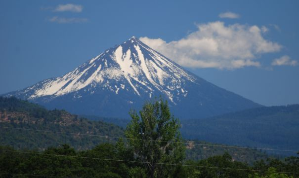
From Eagle Point in the daylight rather than Mt A in the full moon, and frankly, just another volcano. See one, you seen em all.

--

I could have named this after the John Denver classic Some Days are Diamonds, but that would be too easy, no?

Title from The Judds' Turn it Loose, which is kind of a nice easygoing country song for folks who don't wanna try all that hard.  I mean, yes, I like the song.

Eagle Point gets its name from the eagle on McLaughlin that is visible in the shot above. I wish somewhere around the Sound with a boring name--like Burien or Buckley or Renton or Kent--was instead called Elk Head.  That'd be fun.

*54-40 or Fight, but you know that.

You can't even see the Eagle from up here.


Wednesday, October 4, 2023

If you stay, it'll get better.

 The last turn I made at Mt Ashland was the most painful single second I have ever experienced.  Broken arm, blowed out knee, wisdom teeth, lifelong back trouble, migraines, none of that hit like that moment by the rental shop, the only tele turn I attempted in all of the nearly snowless winter of 2014. 

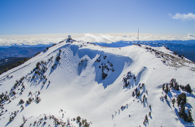
Mt Ashland, Siskiyous, State of Jefferson.  Not exactly Mecca, but you'd be wrong to omit it from your dossier.  Just look at that gorgeous Riblet fan up there!  Seriously, get after it.  Photo via mtashland.com

The hills above Ashland, Oregon have a pretty diverse plant community.  To the northeast of town is oak savannah, right up into a high treeline made by Doug fir and ponderosa.  Down low, it's almost barren, reminiscent of the Great Basin.  Rangeland, sparse white oak that may have been more prevalent long ago.  It's hot, the afternoon sun hitting at right angles in three dimensions on the steep hillside.

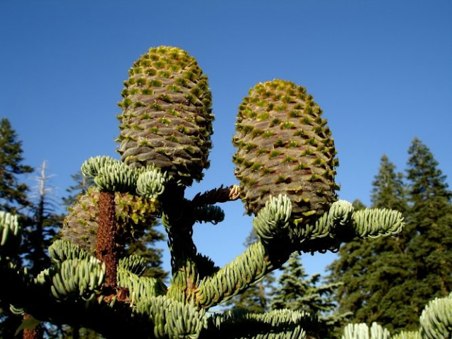
To the south, it's cooler, calmer.  Where the heat on the southerly aspects northeast of town make the air feel hectic and the bugs aggressive, the steep, damp, dark mountains south and west of town are quieter, full of shadows.  The streams that drain the watershed are small, collecting together as they tumble.  The hillsides are heavy with the trees of many species, and the landscape changes with aspect and elevation.  The lowest forest is ponderosa and madrone, the soil a combination of slowly decomposing pine duff and even more slowly decomposing granite.  Late in the summer, it resembles moon dust on the trails.  As you climb the drainage, the ponderosa gives way to Doug fir, and eventually to mountain hemlock and Shasta fir.  I love conifers, and I'd be lying if I said I didn't feel there's a hierarchy among them.  Ponderosa is a widespread species, with many subspecies, and the Klamath-Siskiyou variety (ssp benthamiana) is gorgeous.  Red, red bark.  Tall, imposing, healthy.  Cones that won't kill you, not like a sugar pine will. Wet-side Doug fir, too, feels bigger and more, I don't know, anthemic than its Rocky Mountain counterpart.  It's the higher-elevation trees toward the Siskiyou Crest, though, that stand tall for me.  Mountain hemlock, reminiscent of but stouter than its wetland cousin the Western.  The droopy tops more upright, and the profile more suited to shedding snow.  Above them all, the Shasta fir.  It's a hybrid of some sort or other, depending on your perspective as a lumper or a splitter, of two majestic true firs representing two very different floristic provinces.  From the north, the noble fir, and from the south, the red fir.

Them's some cones, brati.  Abies x shastensis.  Pic from the American Conifer Society.

The crest above town is part of a bridge between the Cascades and the Klamath Range. Mt Ashland itself is the tallest peak on the crest, the tallest in the Siskiyou subrange.  Before we moved there for Amy's Masters program at Southern Oregon, the Siskiyous for me represented only the Summit on I-5, which frequently closes for weather due to its just-high-enough elevation and the sheer volume of trucks and other travelers who use it, and the Shakespeare Festival.  The three years we spent in Ashland showed otherwise, that the land surrounding it is a jumble and a crossroads, old and new piled up and twisted, with deep canyons and ancient species minding their own business.  Where here in the desert of southern Idaho I can count on one of Yoda's hands the conifer species, there are places near Ashland with ten or more in a small space.  The Miracle Mile due south in the Russian Wilderness has at least 17 different conifers, possibly 18, all within a square mile.

On a winter day with just the right flow, one can experience a twenty degree drop in temperature from Exit 14 to downtown, around two and a half miles.  My friend Rob used to live out by the golf course there, and one day when I woke up above the bike shop we both worked at to fog and freezing temps, he thought he'd ride in to work without a jacket because it was darn near sixty degrees at his house.  He walked through the door a little disoriented by the change.  This sorta deal isn't unusual under an inversion regimen, but that change is always with elevation, not just heading two and a half miles west.  It's that same Summit, the one that bedevils so many OTR truckers each winter, that allows strong southerly downsloping.  The warm Central Valley far to the south will be under high pressure, with the Cascades to the north being pummeled by yet another east Pacific low.  Wind will shoot the gap between Pilot Rock and Mt A, and drop down to the valley, heating as it compresses.  The flow usually isn't strong enough to scour the cold air much north of the bottom of the hill, so just that little Mediterranean pocket lives in blissful ignorance of the damp cold a few feet away.

The Bowl, Mt Ashland.  Them shits is right.

We moved to Ashland at the end of April in 2011, a couple days after our only nephew was born.  It was a long day, leaving Greenwater early and driving mostly straight to Ashland.  We got in late in the evening, and my parents helped us carry our lives up the twenty-two stairs to the surprisingly large apartement above the bike shop.  When Merrill and Ron tacked the apartment onto the building in order to fill the "owner-occupied" requirement that came along with being a retail spot in the Hysterical District, they were quite ingenious.  A spacious kitchen, stairs with storage leading up to a raised living room and one of the bedrooms, a ladder up to two rooms that could be offices, storage, bedrooms, a ganj-grow, whatever the Ashland hippie of the early 80s could desire.  It wasn't perfect.  The baseboard heating was inadequate to those damp inversion mornings, and the third-floor elevation without a/c or strong circulation meant we spent a goodly sum on fans and the loud window unit that did its best to keep us only somewhat too hot rather than way too hot.  The Armory (an historic building, to fit its surroundings) hosted shows sometimes that would keep us up late at night and into the early mornings.  We had a spacious attic that was technically shared with the shop, but Merrill hadn't really used it in some time.  The location downtown was ideal, walking distance to most things and riding distance to everything else.  We drove across town to the Shop'N'Kart by choice, because it had both the best prices and the best selection of any store in the valley, otherwise the cars didn't rack up many miles.

We left Crystal that year at the waning end of one of the biggest winters I have been a part of.  A particularly potent spring pattern coated the entire Cascades in a volatile snowpack.  Baker, for instance, got 227" in March. More than an average wet season, for instance, at Bogus, and a number that until this past winter ('023), I thought I wouldn't have the pleasure of skiing again.  At Crystal, it started snowing around the 15th of February, and for at least 8 weeks, there was measurable snow each day.  Not most days, each day. That could obviously be an inch a day for a week, but many times it was eight or ten or fifteen.  Colin Meagher had an ad in one of the bike mags that summer, a photo at Chinook Pass with Keith Rollins standing tall on his road bike, dwarfed by the fifteen-foot snowbanks.  Fifteen feet of snow in June, below 5500 feet.  It was a hard choice to make, leaving home, leaving that much snow behind.  It was at the end of a long run, frustrated, feeling trapped, maybe made a little in haste, but not one I would actually change if I had the choice.  We could have simply held on like the old barnacles so many ski area lifers become; crusty, angry, combative, entrenched.  Mossbacks.  It's easy to romanticise what might have been, but one doesn't really know, now.

THE Mossback.

We missed Closing Day.  Crystal moved on without us, got busier, more anonymous, hipper, more 'grammable.  I mean, the Silver Creek drainage has the same physiography, but don't tell all the new folks that. They DISCOVERED the place.  Mostly gone are our ilk, the Carhartt crowd.  LB is flying bush planes in Alaska, and last I heard, pounding nails when he needs to in Greenwater.  Abby's raising a family and fighting wildland fire.  Lizzie just got her Doctorate at the U in SLC.  Liza is in SLC, too, coincidentally, out of contact even though she is likely the fulcrum for Amy and me getting together and staying.  I lost patience and said some stuff and now there's just some good memories and a hope that she's doing fine.  Curtis and Dawn are long since broken up, Laura off doing stuff and I think she's also got a family, Brad has a Sugar Mama, his words, and a daughter.  The base area is a mess, and the community downstream is no longer a part of the day-to-day.  The entire goal of the new owners seems to be selling beer to bored tech workers and soliciting proposals from various middle-management.  (We watched one of these interactions this past February.  It was a scene from Office Space, to be sure.)

The night before we left, we shared some nachos with Sean Bold in Rafters The Bullwheel Rafters, hung out in B Lot with the few folks who were left, and then disappeared ourselves.  No closure.  We woke up, gassed up in Enumclaw, put our respective right feet down, and went to sleep in an entirely different place than either of us really knew.

Hurts to leave home when this is home. The King, CM Southback, on Pa's 75th. Shank Chute, Pinball, Pinball Face, the Toaster, Toaster Face, some rocks that probly have nice lichen communities, Samsquanch, A Basin Saddle where Eli lost his ski and made us lose valuable ski time all those years ago sorry Ma said it's best to forgive but Pa said it's more fun to hold a grudge or at least that's what I tell people cos it's funny I mean at least Brad laughed and Patrick guffawed.

Some years, Closing Day is timely, the second or third Sunday in April, with dirt showing through, sun, slush, and a kind of frantic last hour where you realise you are counting down the runs regardless of most skiers' superstitious fear of actually calling "last run".  Near panic.  Some years, the better and best years, there are a string of closings that last a few weeks, where if you have a thick enough wallet you can ski a handful of Closing Days without ownership, without the bittersweet drive downstream or the sad stumble into the E Lodge for one last night in the hills.

This year, ours was among the latest of any who don't normally do this sort of thing.  We expect that Mammoth will push into the summer each season--they made they 6th of August this year--as will A Basin.  Snowbird and Bachelor always aim for Memorial Day Weekend.  Timberline usually gets a Sunday or three in August.  Bogus, though, is among the crowd of areas closing regardless of snowpack, scheduled in advance, hoping just to make the projected last day.  Last year, we melted out in March and April turns were just hopping over dirt on the first Sunday cos, well, we can't close in March, now, can we?  Closing '019 was a deep day, 14 April, a bit of a surprise.  It'd been warm and dry on Saturday, and even though the forecast was for tenish inches, nobody thought it'd happen, but it was among my deepest days in an already really good year.

This year, though, was different.  Everywhere in the West had a good year, especially south of the 45th.  Everyone knows how big the Sierra went, but the Wasatch was at least one pay grade above.  Alta hit 900 for the first time on record, a mere 625" above the low set back when we were in Ogden.  Bogus--lowly, forgotten by the industry even though they started the affordable pass trend back in the 90s Bogus--hit 360" in mid May, 80% above average. Seven inches shy of Crystal, when in most winters the difference is Crystal 2, Bogus 1.  Or more.  We stayed open fully until the 16th of April, a respectable closing, then enjoyed three bonus weekends until a slushy, appropriately uncertain finale, the 6th of May.  It's the latest I have skied lifts at my home hill since 2002, and even that would require the asterisk of having moved back home after Baker closed.  It was bittersweet, of course, and I missed a good few runs waiting out a persnickety morning gut, and I left as unsatisfied as I always do.  Not because the turns were anything other than great.  They were memorable, and quiet, and mostly in the sun.  The corn snow piled up in places, ran smooth in others, rarely sticky, and, well, very much like I want from my May turns.  Sloppy, challenging, unappealing to most of the boozehounds who headed up only to find they didn't care enough to really do much.  A modest group of us hung out at the top of Chair 1 throwing snowballs until Patrol got impatient and quoted Semisonic quoting the apocryphal "you don't have to go home. . ."  I skied the Other Ridge to the Other Bowl at short-swing pace.  As many turns as possible, stopping long enough for Patrol to almost catch me before moving on.  Then, just like '011, I left unceremoniously.  Other folks were boozing in the lot, natch.  Honking their horns on the way out, yelling, whooping, doing what privileged white people seem to do in these situations. 

6 May 23.  Late enough, for once.  Of course, nothing is ever enough, now, is it?  Hiding from the Eye of Sauron with Closing Day Poles and shadows, Boise National Forest, Boise County, ID.

I'd like to think the ebb and flow of what most folks think of as ski season, November to April, has given me some sort of ability to handle endings.  I don't know that I handle them well all the time, given that I think ski season should run into July or at least until I just don't have the oomph anymore, but I actually feel good about the season for the first time in a long time, probably since before that white flash of pain by the rental shop at Mt A in 2014. Closing Day in 2013 was fun, a day like the 6th of May this year, a bonus Sunday where I skied with my Closing Day Poles for the first time, Amy and I slopping rather expertly through the moguls under Ariel, oblivious to the fact that it'd be the last time either of us would ride the lifts there.  I wasn't satisfied then, of course, but then I can only think of one day in my life where I actually thought "this is enough", and that was 9 July, day 127 on snow in 2002, and I was so exhausted and burnt out that the next year felt like nothing was ever going to be enough again.

I can still picture one specific run, directly under Ariel. We took turns shooting video of each other, probly lost on a phone Amy doesn't have anymore.  We were in progress, just another day in the life, thinking all things would continue onward, and upward.  The snow was that rare commodity, true corn snow.  Huge grains, easy to push around and yet not all that easy to ski until you know what you are doing and are strong enough to do it.  One day among many, and yet like the tall Shasta firs around us, somehow above the rest.  Only a handful of days measure up.  Cinco de Mayo at Alpental in 2006.  Easter, '06,  Closing Day at Crystal. Closing Day at Snowbird in '016. Opening Day, 4 November 2005, Crystal.  Veteran's Day, Crystal, '06.  Closing Day, Baker, 2001.  All of June, 2008, Central WA Cascades.  There's a theme here. Not many beginnings, and a blur in the middle, and then panic.  Postpone the inevitable for one satisfyingly unsatisfying day.

Daffodils before Closing, just the way it should always be. "Historic" North End, BoyCee, ID.

- -

Title from a song Suzy Boguss wrote with her husband, Doug Crider, Just Like the Weather. It was released as a single off her 1993 record Something Up My Sleeve.  Lotta good records that year, from all over the dial.  School of Fish's Human Cannonball, for example and for contrast. It's on the internet, kids.  Find out.

Friday, October 28, 2022

1140, or Why You Can't Trust Numbers, So Here's a List of Numbers

By Eino Holm

The Pacific Northwest is a consistently misunderstood place.  It is home to cities with some of the lowest precipitation totals in the country: Yakima receives 8 inches in a year, Bend gets 11, Boise 12. It has vast arid regions, places bigger than some eastern states, where precip comes exactly as it does in the more famous deserts to the south.  Infrequent and mild winter snow, and periodic summer thunderstorms.  Monsoonal pushes don't happen this far north very often, and in summer, neither do Pacific systems.  Seattle, that northwestiest of Northwest places, is dry basically from the middle June to early October.  If you've ever lived there, or spent time there, you know it may not look like the dry of the desert, but little to no measurable precip falls in that time.  This year, it's the middle of October and I don't think it's rained more than a drip or two up there since June.

Oregon, Washington, and North Idaho. - Brandt and Ryan (The Owner), the only exactly repeated answer.

Is it still the Northwest if you can actually see the volcano?

The general consensus, though, is one of consistently gray, mopey skies, and torrents of water.  If a movie or tv show is set in Seattle, say, or Portland, the rain is always heavy, aggressive, and very visible.  That is not the case.  Nor are the rains aggressive.  They often are unrelenting and destructive in the Wettest Season, 15 Oct to 15 Feb; it will be raining, maybe 5 inches in a cycle, and without the perspective or a puddle or the feel of the water on one's face, it is perfectly possible to think it had already stopped raining.

Oregon and Washington. - Dr J, "Reverend Doctor Super Genius"

Even the boundaries of the PNW are passive-aggressively controversial.  In informal personal polling of random folks (okay, friends, family, and coworkers) and in somewhat partially official research (wikipedia and the internet), the most consistent idea is "Washington, Oregon, and Idaho, except, y'know, not all of it."  I am fiercely (well, not fierce, I'm Norwegian fer heck's sake) of the PNW, and I have lived in its heart and on its periphery.  From the lower Salish Sea Basin and the upper drainages of two small but high-flow Salish rivers to the desert of southern Idaho, the Mediterranean oak savannah of southern Oregon, and Ogden, Utah, not really the northwest at all but good for perspective, and I think all of the ideas are defensible.

From Donny BoBo* to that one place in Alaska. - Dino Voulaj

The most codified of the boundaries seem to be the Pacific, and the 42nd parallel.  Even those aren't wholly rigid.  The 42nd is utterly arbitrary and unnecessarily unyielding.  The ocean is, well, have you been to Brookings during a vintage January Chetco Effect? 80 degrees, fire weather, a bit like Calabasas.  Not northwesty at all.

Washington, Oregon except the Great Basin, Idaho north of the Snake, west of US 93. - Brother John

Definitely PNW

It seems everyone is trying to put their interpretation of the phrase into a solid quasi-national entity. We are so used to and governed by boundaries that any notion of fluidity makes people uncomfortable. I have heard from folks who grew up back east that the PNW is just the strip of land from the Cascade Crest to the coast, either because they heard the PNW is wet and that's where the wet is, or because it's a solid, knowable boundary. As with all things, knowable is one thing, and solid is another entirely. Medford is west of the Oregon Cascade Crest, but averages just 18" of water a year. Kellogg, Idaho, is 300 or so miles east along a sometimes boring I-90 from the crest, and at above 30", averages only a Yakima's year shy of Seattle.

West of the Rockies, from Tahoe to the Bering Strait. - Crimski

In The Good Rain, Tim Egan describes the Northwest as the "reach of the Columbia." This, finally, sounds somewhat sensible.  The Columbia, after all, is a World River.  Not as well known as the Ganges or the Mekong, nor as big, but it drains significant portions of one Canadian province and four American states, and minor portions of three other states.  The bar at its mouth is dangerous and deadly and utterly humbling and beautiful.  The highest point along its crest is, understandably, Columbia Crest, the highest point on Tahoma.  The river drains the western slopes of the Canadian Rockies, vast and semi-obscure plains, giant spires of granite and anger from Valemount, BC (which is, like, WAAAAAY up there) to Nevada, northwesternmost Utah, and the Tetons. So, again, another solid boundary that is not so solid.  In fact, one of the furthest points in the entire basin from the Pacific is, naturally, the headwaters of Pacific Creek in the Teton Wilderness, well east of the Teton range itself, at a unique spot where one creek separates into two creeks that drain into different oceans.  This is Wyoming, obviously, which has for its eastern geography plains that are part of the Great Plains.  The Plains owe their arid existence to the Rockies, which are obvs east of the west which is OW MY HEAD.

West of where all the scrubby landscape begins. - Taylor

Are we looking out of the PNW into the Inland NW? (Screenshot of Mission Ridge's well-placed summit cam.)

This is my central problem with the idea of boundaries.  Vague and hard to defend.  Unnecessary, as we all came from the same ancestor, which to me suggests commonality of purpose and need, our perpetual and deadly desire to prove that wrong aside.

Cascadia.  - Dustin

The point? Other than truly enjoying good debate silly argument, it's skiing.  The American portion of the PNW has around 45 ski areas.  Some big, some little, some famous, some, well, most folks don't know Rotarun from Rotorua.  (I see you raising your hand in the back, New York.  You win. 52 ski areas, according to the NSAA.)  As we shift borders around for one reason or another, the number rises and falls.  Someone in passing mentioned Sun Valley isn't PNW, but Bogus is.  Trouble with that is that I can see the same peaks from the ridgelines of each mountain.  But then again, saying Bogus is a Rocky Mountain ski area kinda rattles my teeth a little, cos BoyCee just feels absolutely nothing like Albuquerque, and yet they'd be categorised together if we took everything literally.  Peakbagger says Brundage is in the Rockies, and Tamarack is in the Columbia Plateau, but you can see each ski area from the other on a clear day.  So, since categories are kinda silly, I'll just stick with the simplest answer: Washington, Idaho, and Oregon, and, like, one small part of California cos I want to and also volcanoes.  Major continental ranges and rivers are part of multiple regions.  Rather than solely defining the region, I'd say they simply play a part.  Definitely a big part, but they never tell the whole story.

As much as I'd like Southern Idaho to also be a part, I don't think it is. - Jake

Which finally brings me to a conclusion of sorts.  I was riding Chair 2 at Bogus the other day, Summer Only Riding Park Closing Day, with a remote-worker guy from some to-me-unknown place.  He was asking all sorta questions, and being me, I could not help but answer them honestly.  This is to say I hemmed and hawed and told him to define his terms more acutely.  "Does Bogus get many powder days?" begs for clarification; how much is a pow day? "Eight inches or more," he said, surprisingly confidently.  I mean, I've skied "powder" that was three inches overnight, and it outskied some ten inch days, but whatever, yeah, let's just pick a random number.  At Bogus, not many.  

All of Oregon, Washington, and Idaho, and Montana and Wyoming might be. - GMRII

Not just potatoes.

At any rate, he also asked if I could compare Bogus to Tamarack.  (Bigger, and smaller at the same time.  Like so many things.  Srsly, can you actually not figure these things out from just skiing? That's how I know these things, and I don't have the privilege of moving around at will while holding down a job.)  I took him at his word and said, simply, that they are different.  They require different skill sets, and if you've the money for new or the patience to buy used, different gear.  He tried to drill down on the exact size again, and when I said Bogus has over 1000 more skiable acres than Tamarack, he seemed surprised.  (He also had never heard of Baker, so maybe I'd set my bar too high.)  Bogus is bigger than Sun Valley, too, also, even with the new expansion.  I find this sorta underdog-punching-up scenario cool, and I relish the opportunity to share such things with folks who don't already know such things.  I don't know why, but it gives me some significant satisfaction to see a little brain-gear smoke out the ears when I say "Mt A has a higher base elevation than Bachelor." 

 Didn't you ask that last week? - Chris

When I got home, I looked for a published list of PNW ski areas by size, and did not find one.  Some other blog or mag from way back or other random collection of 1s and 0s might have something, but herewith is what I could find from surprisingly unverifiable Wikipedia articles and ski area website infos, with any ties alphabetised to pretend I'm not biased, and maybe a comment or two:

- Bachelor, 4600 skiable acres, when it's sunny.
- Schweitzer, 2900
- Bogus, 2600, on weekends and if you aren't afraid of a little willow-whipping in your pow-slash routine.  Seriously, just try it.  Almost all of it goes, and the parts I can think of that don't are right under Chair 6, so Patrol can find you and people can yell really helpful things from the chair like "That's a creek you're stuck in!" or "Hey! You're almost there!"
- Crystal, 2600
- Sun Valley, 2400, but that's after a very recent expansion and includes Dollar, which is a small bit of marketing shammery.
- 49 North, 2325
- Hood Meadows, 2150, and like Bachelor, that is only when it's sunny.  These Cascade volcanoes have a way of being stormy for days or weeks or months (1999) at a time.
- Mission Ridge, 2000
- Snoqualmie Pass, 1994, the combined total of 4 actual ski areas, one of which--Hyak--is rarely open, and which can only be fully connected by car or by paragliding off Denny.  Also, "Summit-at-Snoqualmie" is just artificially fancy.  East to west, it's Hyak, Ski Acres, Snoqualmie Pass, and Alpental. Regular-sized marketing spammery.
- Brundage, 1920
- Mt Spokane, 1704
- Timberline, 1685, but that's combined with the former Summit Pass Ski Area, which Timberline recently purchased but which is not yet connected without creative skiing, and which also is maybe never fully skiable because (according to a dude I talked to on Palmer who totally had an Employee Jacket and spoke with what felt like much authority) the Forest Circus doesn't allow them to run Jeff Flood while Palmer is also running.  Also, like, when them Pacific cycles is slamming the side of Wy'east, Palmer is buried, and when the Palmer chair itself is melted out and runnable, the lower mountain is melted out to dirt, mostly.  So, maybe a lot of marketing scammery.  The views from Palmer and the Magic Mile are downright righteous, though.  No marketing needed.
- Silver Mtn (Some still call it Jackass, cos, why not?), 1600
- White Pass, 1402
- Soldier, 1150
- Stevens, 1125
- Pebble Creek, 1100
- Tamarack, 1100.  This tie is an interesting one.  Both ski tall and narrow, with some real challenge in the woods when you know where to go.  Beyond that, they have almost nothing in common save that they are both, indeed, ski areas in Idaho.
- Lookout Pass, 1023, expanded this year and with plans (and, I think, the Okay from whomever or whatever) for more.
- Anthony Lakes, 1000
- Baker, 1000.  I'll pause here to let you decide whether or not you believe that one.  I love Anthony Lakes without any qualification, but in my mind, I can fit the entire place within the confines of the front side of Pan Dome at Baker. Then again, my entire point here is that definitions and numbers don't tell the whole story.

Views, a Riblet triple, Abies lasiocarpa, good snow, lesser-known mountain range? I'm in. (Anthony Lakes, photo by Snowsnapper, public domain.)

- Mt Hood Ski Bowl, 960
- Lost Trail, 900.  Hey.  It's got at least 13 turns in Idaho.  And besides, it's within the Reach of the Columbia.
- Hoodoo, 800
- Kelly Canyon, 640, sadly, no longer serviced by the legendary homemade Riblet lookalike they built from copied, possibly stolen, schematics.  Kelly's is now open Sundays, and according to my source, who like, knows the new owner cos bikes or maybe Rexburg is a small town; there might now exist within the creek drainage alcohol, which if one is so inclined, could be supped for the purposes of mild intoxication, known in many circles as "a good buzz".
- Mt Shasta, 635 as of this winter with the new Gray Butte chair.
- Willamette Pass, 555, with the additional claim (for now) of having the only 6 pack in Oregon, and with the dubious and maybe not measurable "steepest groomer in the US", RTS, which supposedly overtops 50 degrees. Might need to head there some day.  Or ask my niece at U of O for a report.  She's from Colorado, and as everybody knows, when you list skiing, Colorado is Number One.
- Loup Loup, 550.  I've ridden their chair, but never been to Loup Loup.  Think about that.
- Pomerelle, 500, with some rad orographic snow showers if the flow is right.
- Bluewood, 400.  I just have to point out here that I love literal names.  Bluewood is in the forests of the Blue Mountains.  Perfect.  I also love scientific binomials that are just double names--tautonyms, apparently--like Pica pica and Alces alces.
- Warner Canyon, 300.  Or 200, but as I pointed out above, it's surprisingly challenging to verify these numbers with my limited researching skills.
- Cottonwood Butte, 260, the largest (claimed) area without a chairlift.
- Hurricane Ridge, 250, but according to the kids I worked with at Baker who grew up in Port Angeles, it's like, totally not about the inbounds, man, it's like, endless and stuff.  One of those kids is, like, a big cheese at Baker now.
- Mt Ashland, 240, or 220, or, like, lots more cos the whole peak is skiable and accessible from either Windsor or Ariel and it only takes a little skate along FR20 or even just a quick walk back through the lot from the bottom of the Void.  This, then, brings up the whole challenge of understanding Skiable Acreage in the first place.  It feels like ski areas just guess and then try to defend either through repetition or a shoulder shrug.  We spent three winters at Mt A, and while I don't think it is a huge or even mid-size place, it felt bigger to me than Anthony Lakes does.  My perception is by no means perfect, I know.  Maybe some joints just count cut runs and others count every last feather of snow within sight?
- Spout Springs, 200, on pause while an operator is sought.  Fingers crossed.
- Ferguson Ridge, 170
- Bald Mountain, up near Pierce in 6C, not the one in 5B or the random pile of rock in NY, nor the totally awesome and totally not creepy at all piece by Mussorgsky, 140
- Magic Mountain, again, the one in 2T, not the one in VT, 120. There is an abandoned platter liftline across the road, which I don't think is included in the total, and rumours of replacing it with a used chair.  Or they might replace the carpet.  Who knows?  At any rate, Magic is cool and funky and up a long, very pretty draw with a nice Lodgepole right next to the top shack.  Not big, but that never matters. Also, this is not the smallest ski area in the PNW that has a chairlift.
- Sitzmark, 80; neither is this.
- Echo Valley, 70
- Cooper Spur, 50, home to the final Riblet installation ever.  That's worth something right there. Cooper is the smallest hill in the PNW with a chairlift, too, for good measure, too, also.
- Little Ski Hill, 50
- Snowhaven, 40
- Rotarun, 15
- Badger Mountain, 10
- Blizzard Mountain, some acres.  Can't find numbers.  It's a platter and one groomer. Guessing between 5 and 20, but like most folks, I do not know by looking what an acre actually is.


Boise, City of Trees. Tree City USA award recipient for 44 years.  That's a lot of trees, cos allegedly Boise! was the cry from Frenchist trappers back in the day, and like, "les bois" means trees, and so does PNW, so there.  Bogus Basin is the highest, furthest, most elevationary point in the photo. (Credit: Boise Metro Chamber of Commerce, via flickr.)

* Boise.  That's what Angel means when he says Donny BoBo.  It's, like, funny.


pps:
"With a base elevation of 6300', Mt Bachelor offers the highest base elevation in the Cascades. Paired with its location on the eastern side of the Cascade Crest, the result is consistently high quality snow not typically found in the Pacific Northwest. 462" of snow falls during an average year."

- Found on the internet. A good example of confusion seemingly based in the need for things to be cooler than they are. Bachelor has the highest base in the Cascades, yes, and the highest summit, too, and plenty of great skiing and is huge, but while it is east of the Crest in the riverine sense, weather doesn't care. I have skied my share of borderline mank at Bachelor, and through at least two full-on rain events there. Also, not for nothin', both Anthony Lakes and Mt A have higher bases, they're just not in the Cascades. Mt A is even the first peak west of the official reach of the Cascades, which doesn't really mean anything either, but again, it makes you, like, think, y'know?
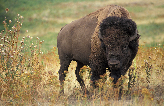
Bison bison